

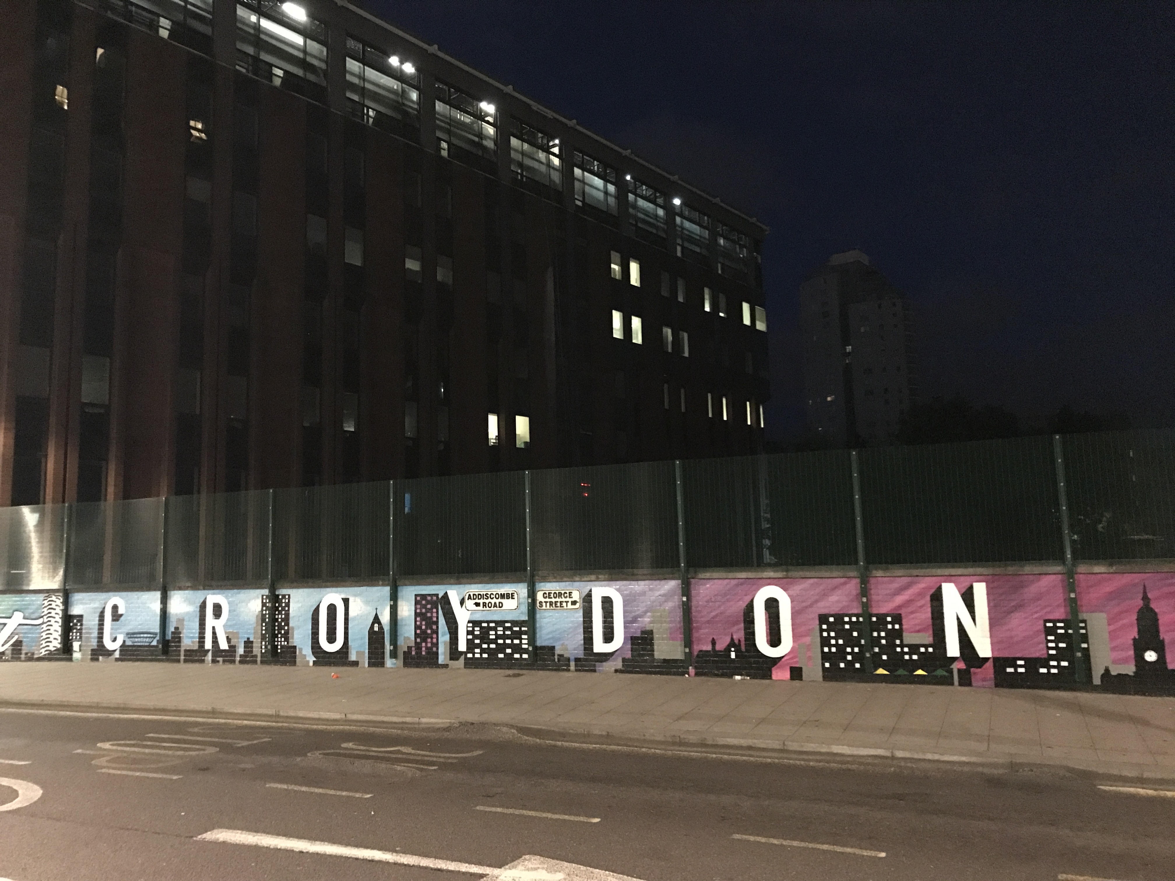
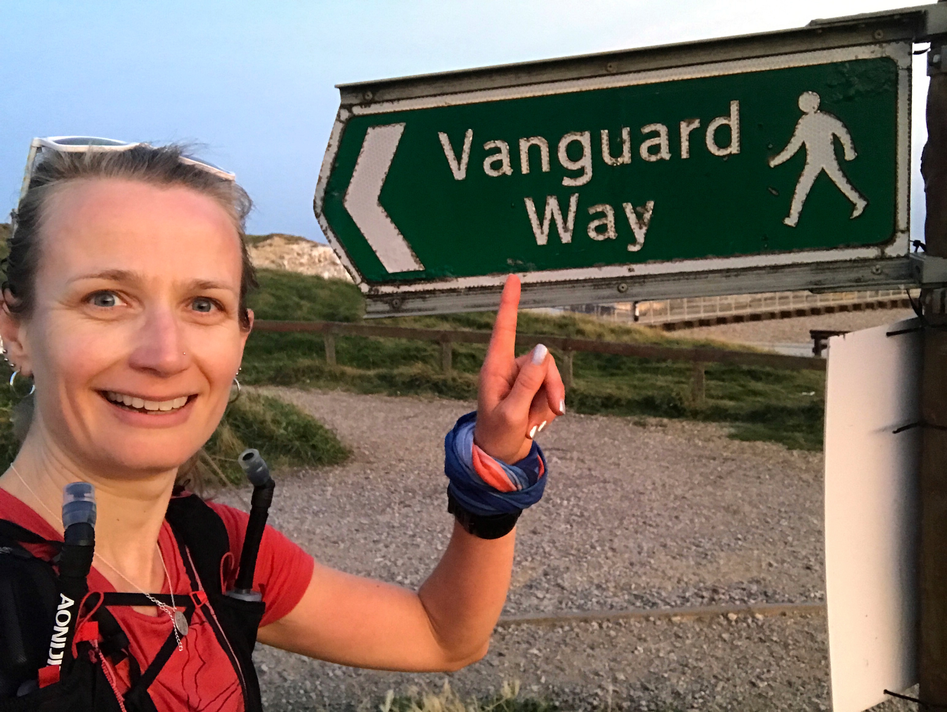
The Vanguard Way (VGW) was where I discovered trail running in 2016. Before the Vanguard, I was a road runner pounding the pavements of Croydon day after day. I knew no different.
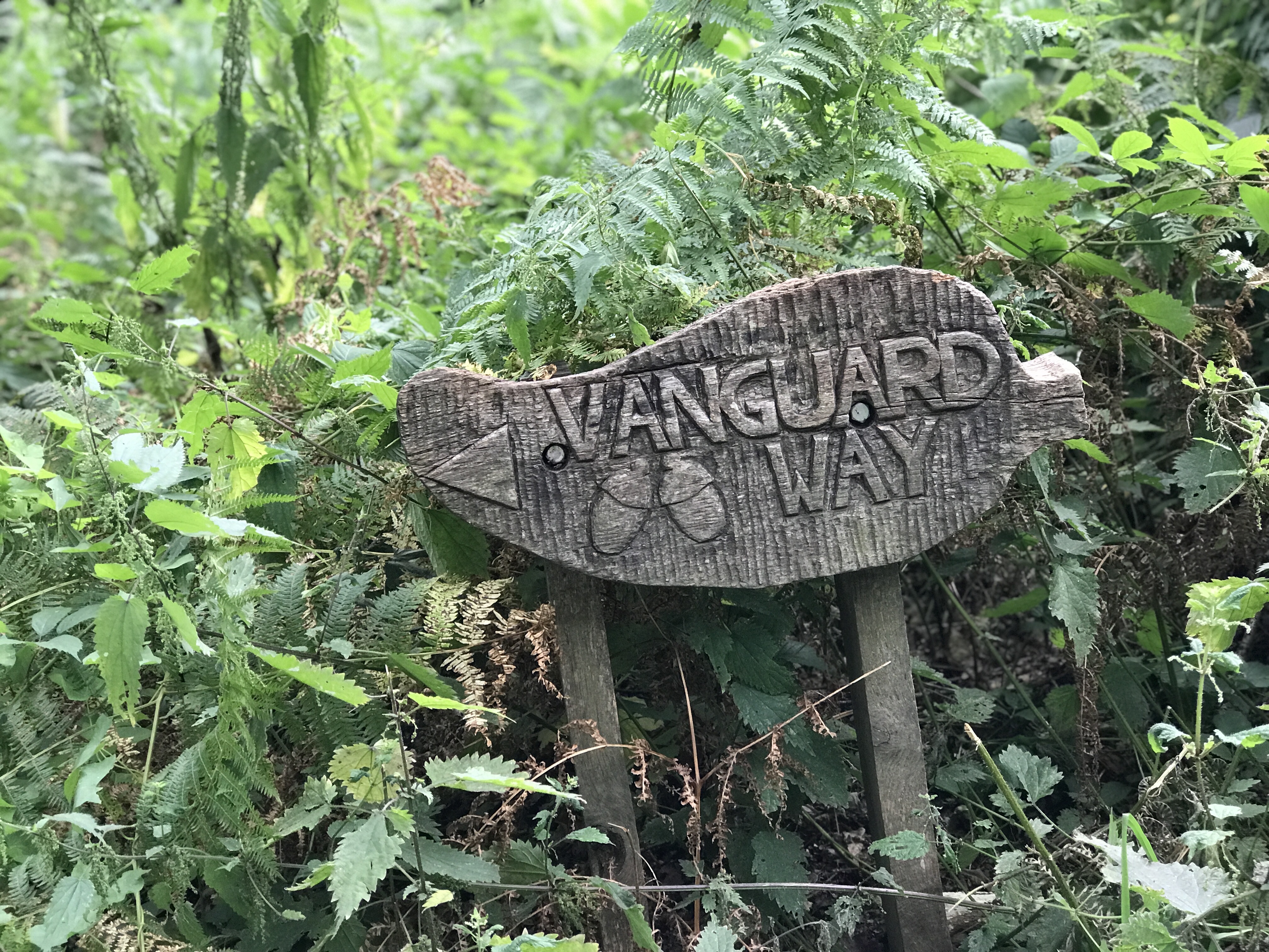
One evening early in the summer, the club run took us off the roads & onto the trails of Croydon. I entered a whole new mystical world. Over those summer months with Striders, I discovered a wonderful side to Croydon that I never knew existed; woods, forests, fields, tracks & trails. I started to fall in love. One evening we ran a few miles along the Vanguard Way. I saw signs around the woods, my curiosity was piqued.
I went home, googled ‘Vanguard Way’ & discovered a path that started at East Croydon Station & wound its way 68 miles south to Newhaven on the coast. In the summer of 2016, 68 miles was an inconceivable distance.
I ran the club run by myself, once, twice, three times. Creeping a little further along the trail each time before one day I plucked up the courage to try running a significant section.
I set off on my first big trail adventure in an old pair of road shoes knowing nothing of gpx files, apps or watches that told you where to go. I armed myself with a map printed off the internet & faith in signs to run the first 18 miles to Edenbridge, where I knew there was a train that would take me back to Croydon.
I ended up in Merstham, some 20 odd miles away from Edenbridge.
I lost the VGW six miles in just past Chelsham. A sign was deceptively hidden & my inexperienced trail eyes didn’t know where to look to find it. I ran round in circles for what felt like hours trying to find the path both on the ground & on my useless printed-off-the-internet map before giving up & following the signs for cycle route 21, which having cycled some of, I knew would take me to Caterham.
With numerous accidental detours & missed turnings, it took me another two attempts to find my way to Edenbridge. By then I owned trail shoes & had learnt how to import a route into the Google Maps app on my phone – but I still didn’t have a watch capable of navigation.
Finally arriving in Edenbridge I felt an enormous sense of pride. It had taken me over a year to get there but I had done it. I had navigated myself to somewhere I didn’t know. In the interim period, I had almost fully transitioned to trail running & had run my first ultra, the North Downs Way 50. I’d even managed to find my way along the North Downs Way in training before race day. Admittedly the NDW is a lot better marked than the VGW!
But nothing beat the satisfaction I felt when I made it to Edenbridge.
I immediately began to plan to run the next section, wondering if I could eventually make my way along the whole trail.
But then brighter, shinier more exciting challenges came along. I abandoned the Vanguard for the South Downs, the North Downs, the Serpent Trail, adventures on the SWCP & climbing Pen y Fan. I ran another 50 miles and another. 100km & 100 miles. Occasionally I’d cross paths with the Vanguard as I was off exploring another trail & I’d be reminded of that early dream.
One day I said.
One day.
August 2021. Post the pandemic we don’t talk about, work had been relentless for several months & I was tired & in need of some time away from my camera & computer. I cleared a few days in my diary.
Some five years after first discovering the Vanguard Way I set about planning a few days of back-to-back running to cover the whole path from my hometown of Croydon to the trail end in Newhaven. At the start of the year, I had bought a lightweight tent, sleeping bag & camping stove & was keen to try it out.
I reverted back to Google to plan. I was primarily looking for campsites, small, rustic ones close to the trail & local amenities, but also I was trying to find an accurate gpx file of the route to upload to my watch. I am now fully engaged & on board with digital navigation!
Doing so I stumble onto the Fastest Known Time (FKT) website.
There was no female FKT for the Vanguard Way…
I wonder…?
I click on the FAQs. The rules. The guidelines for submitting a run. I read the report from the male VGW FKT holder.
I wonder some more.
“An FKT is, it’s exactly what it sounds like: the fastest known time on a certain route that is at least five miles long or has 500 feet of climbing. Your goal is to get from Point A to Point B as fast as you can. A few things differentiate it from an actual race. First, you are not technically racing anyone else while you are running. You pick the date & start time, & you either try to beat the existing fastest known time or you run as fast as you can to set the first official fastest known time on a new route. Secondly, the entirety of the event is on you; there are no course markings or race marshals directing you where to go & no aid stations along the way. Anyone is allowed to attempt an FKT on any trail at any time at any point in a year!”
I abandon looking at campsites & instead look at the first bus to East Croydon Station from my home in the north of the borough, and the last train from Newhaven to Croydon. There are 18 hours between the two.
I form a plan. It’s Friday. I want to run on Monday. I have three days to prepare.
Monday 16th August 2021
My alarm goes off at 3:40am. I debate rolling over & going back to sleep but the draw of an adventure is too great & it pulls me out of bed. I’d prepared everything the night before, running kit laid out, bottles filled, snacks prepared, bag packed & breakfast made. All I need to do is brew some coffee, a morning essential no matter the time!
At 4:30am & still in the dark of night, I catch the first bus to Croydon. The roads are unusually quiet but I’m surprised by how many people there are wandering around the town centre before dawn on a Monday morning.
Just before 5am I set off from the unmarked & unremarkable trailhead at East Croydon Station. My only goal is to arrive in Newhaven in time for the last train back at 11pm.
Sunrise is not due for nearly an hour. Under the light of my head torch the early miles speed by. The paths are familiar, my feet know where they are going & I barely need to think. Across Lloyd Park, I’m careful to pick the right path through the centre, so used am I to running the Cross Country route around the perimeter. Conduit Lane & Littleheath Woods. Keeping my heart rate low, as if I was in a race, & my effort levels easy I walk the small inclines through the Littleheath & Selsdon Woods.
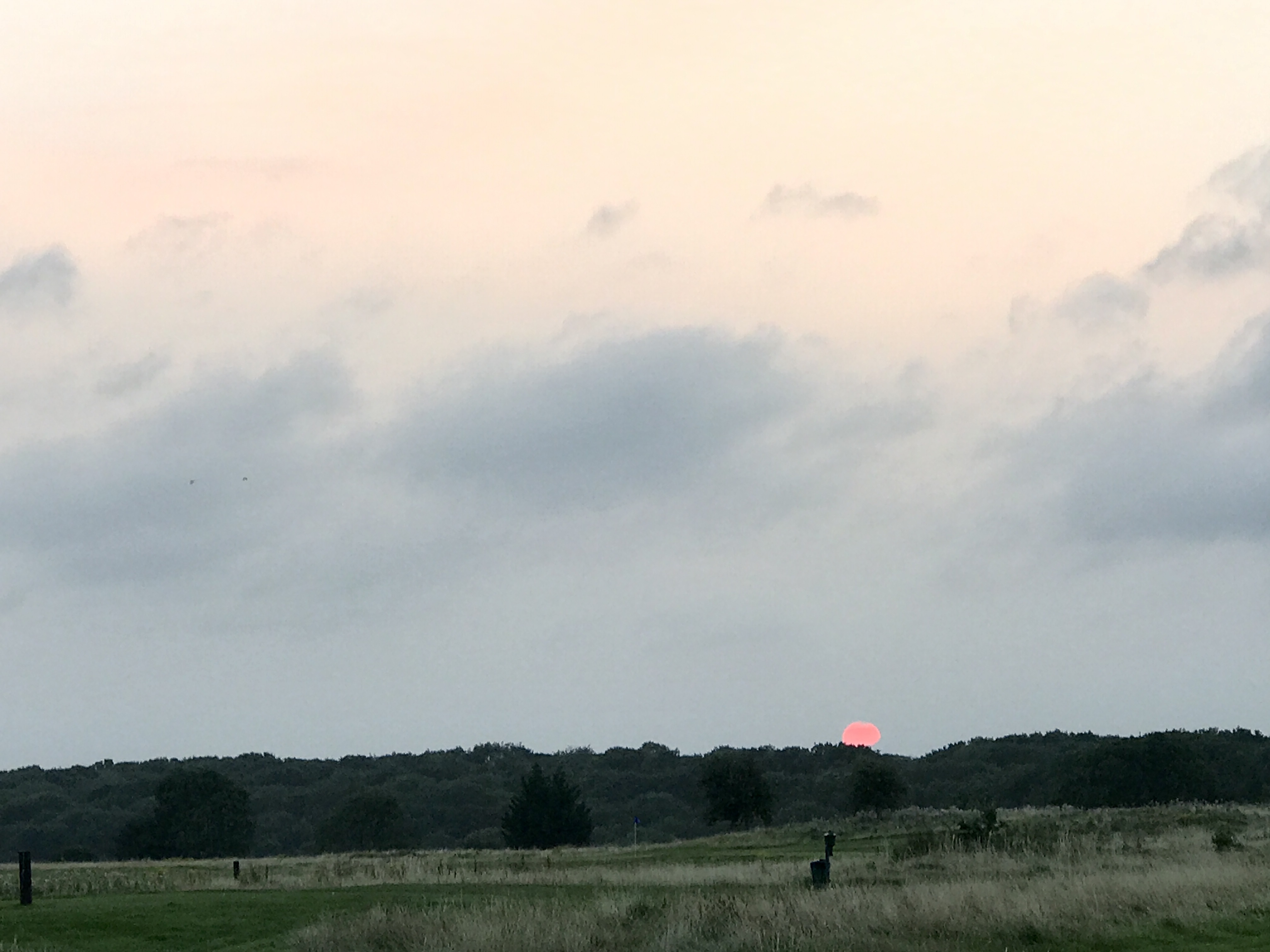
Six miles in on the edge of Farleigh the sun rises. A deep orange ball in the morning sky, only visible for a matter of moments before it slides silently behind a blanket of cloud. I hope it reappears during the day.
I’m lost in my thoughts, thinking about the day ahead.
As much as I have spent the past couple of days planning, in many ways, I am not prepared & I don’t know what to expect. And that makes me slightly nervous.
Only nine weeks since completing SDW100 & five since attempting WW100, I am confident I can run the distance. But can I run the distance alone? The furthest I have run by myself outside of a race is 35 miles. And that was tough. I worry about fuelling, my nemesis in races. I worry about not finding anywhere to top up on water, despite having a list of shops & pubs on or near the trail in my pocket.
I worry about navigation, even though I have the route on my watch, imported into Google Maps on my phone & OS Map downloaded for offline viewing. I know my way until Edenbridge at mile 19 but then I know nothing of the trail until it converges with the South Downs Way some 43 miles later in Alfriston.
I may be a little apprehensive of the unexpected but at the same time, I am looking forward to my adventure. All I am doing is going for a long jog, and I like jogging. There is zero pressure or expectation. I haven’t told a soul what I am doing, not even the husband (I told him I was going for a long jog & would be home later… I thought he might try & talk me out of it!).
This telling no one stems back to fears from my early days of ultra running; if I don’t tell anyone what I am doing, then I won’t need to tell anyone when I fail. I don’t know why I have reverted to this mindset & I berate myself a little for doing so. In my head, I am confident I will make it to Newhaven.
I just need to keep moving.
And not get lost.
I am running self-supported. This means I can have as much support as I can find along the way, but not from “any thing or person just for me”; any support I employ must be equally available to anyone else. I can stop at shops, pubs, cafes, etc, to refuel.
Unsupported, you cannot do this, you have to carry all that you might need for the duration of the run, although you can top-up at public taps if they are available. The third FKT category is supported, this is where you have a crew of people who are there to help just you.
I couldn’t do an unsupported run as I knew I wouldn’t be able to carry enough food & drink for the whole day. As far as I can tell there are no public taps on the Vanguard route (unlike the South Downs Way which has an abundance of them). I start with two litres & with each litre adding about a kilo of weight onto my usual trail kit (first aid, warm base layer, waterproof, etc), which makes my bag quite heavy enough!
In the kudos stakes, self-supported supersedes supported & unsupported supersedes self-supported.
Back to mile seven in Chelsham. The path I couldn’t find back in 2016 I now confidently run along, ignoring the private property sign nailed to a tree. Five years ago this sign threw fear into my mind & was the reason I got lost. Now I know it’s just placed there by an overzealous farmer trying to deter people from using a public right of way that crosses his land.
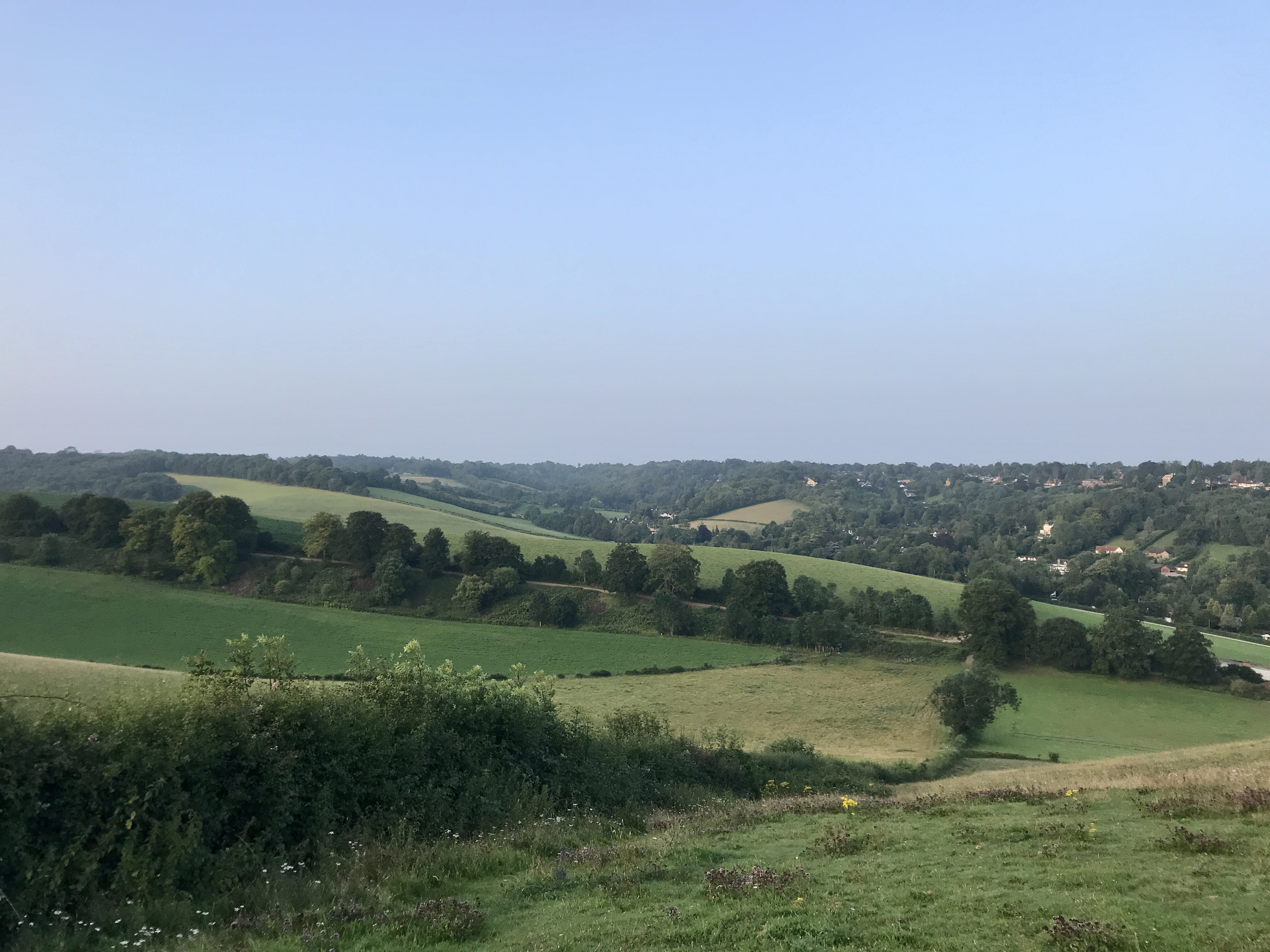
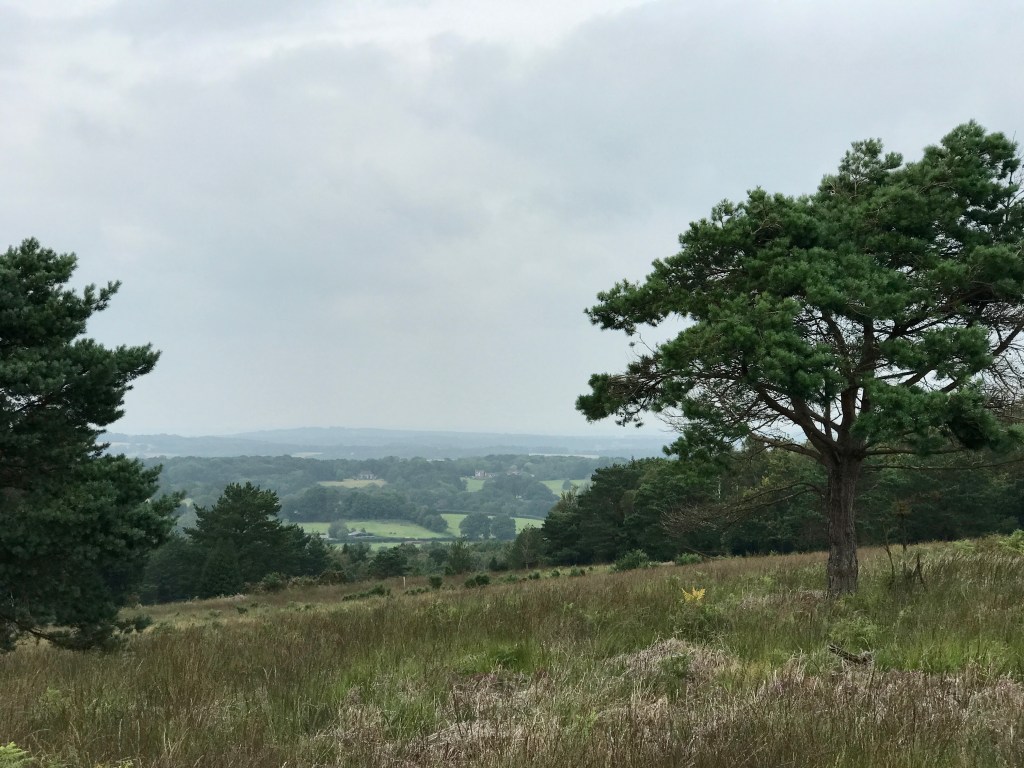
Skirting around the edge of Henley Wood & I’m at the top of the first significant hill; Nore Hill. It’s been a gradual, almost unnoticeable, climb over many miles. Behind me sits the London skyline, in front, the Surrey Hills. As I fly down the subsequent steep descent my mind ponders that although I’m some 90+ minutes into my adventure, most of London behind me is not yet awake.
On the ridge at the top of Botley Hill, nearly the highest part of the VGW route at 853 feet, I look out over the M25. Rush-hour traffic is almost at a standstill. I know where I would rather be on a Monday morning. Here, with the motorway on my right, the Vanguard Way shares a mile with the North Downs Way. Another path familiar to my feet & home to many happy trail memories.
As I run I’m trying to remember what I see & how I feel because I know I will need to write a report for the FKT people as part of the verification process. 15 miles in & running over the M25 I’m simply feeling good. The day is warming up with the sun peeking out from behind the clouds every now & again. It’s pretty perfect running weather.
At this time of day, the trails are silent & bar a couple of dog walkers & farmers I don’t see another soul. I revel in the silence & solitude, sharing the path only with cows who eye me warily & sheep who scatter as I approach.
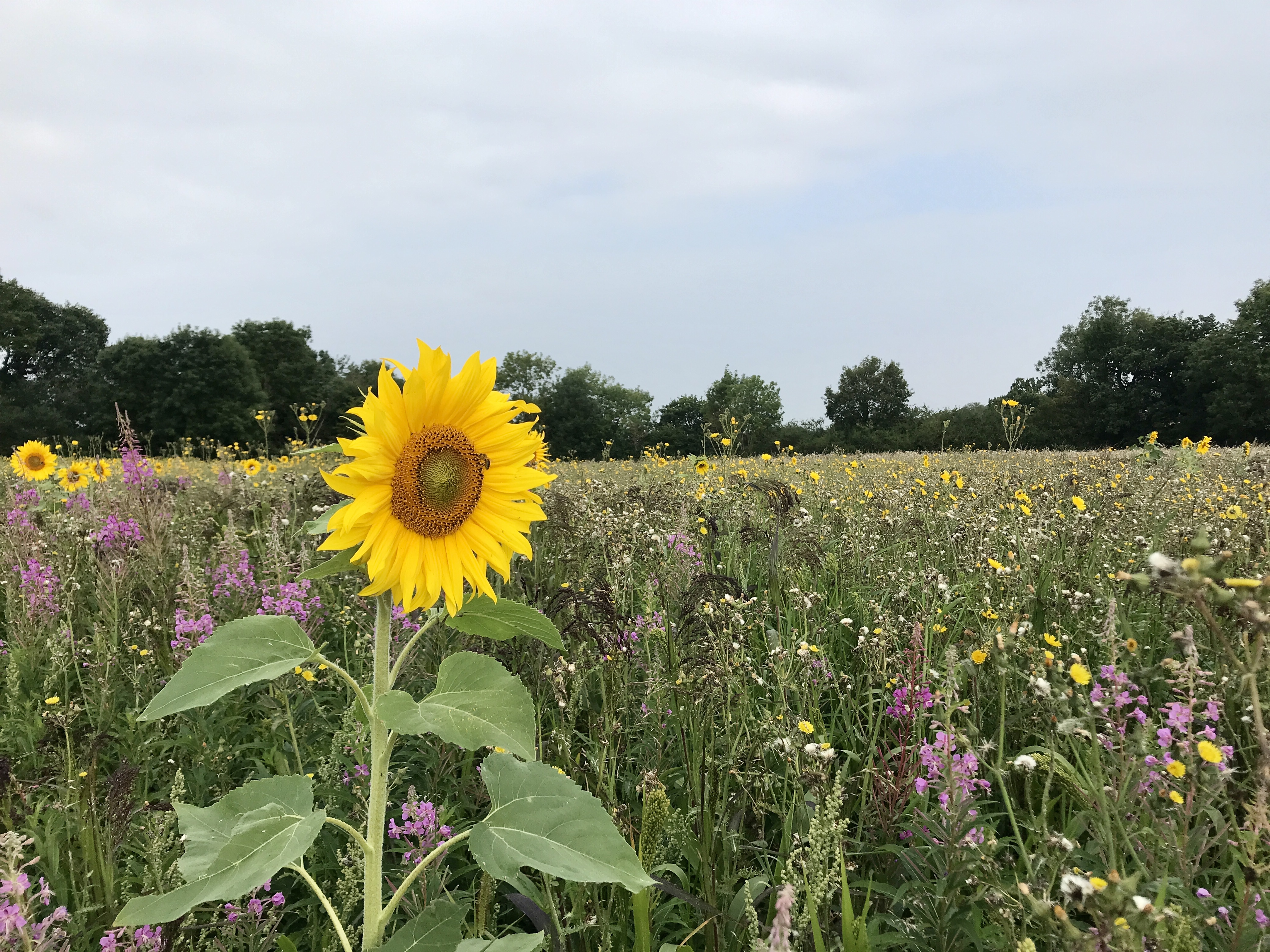
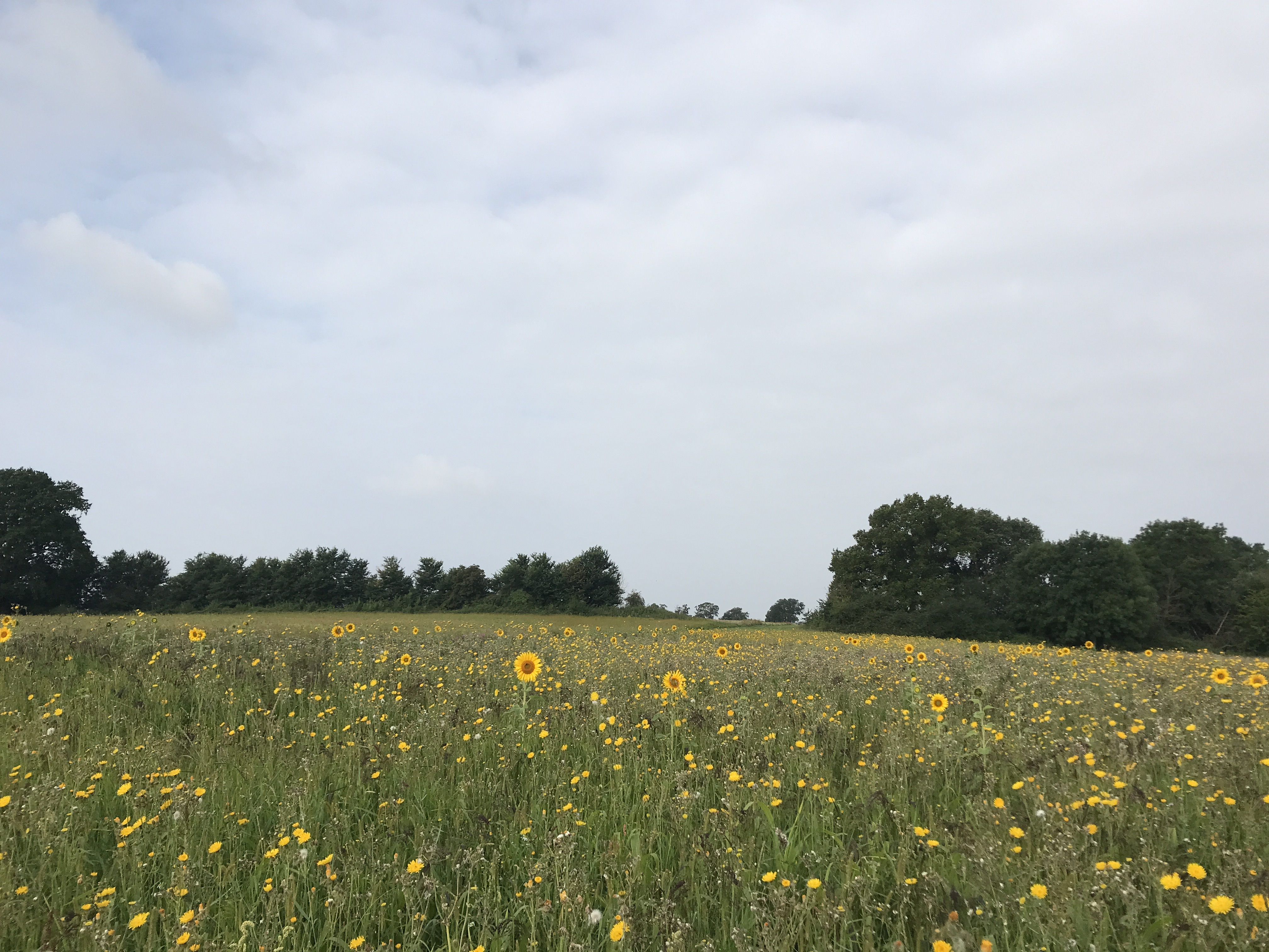
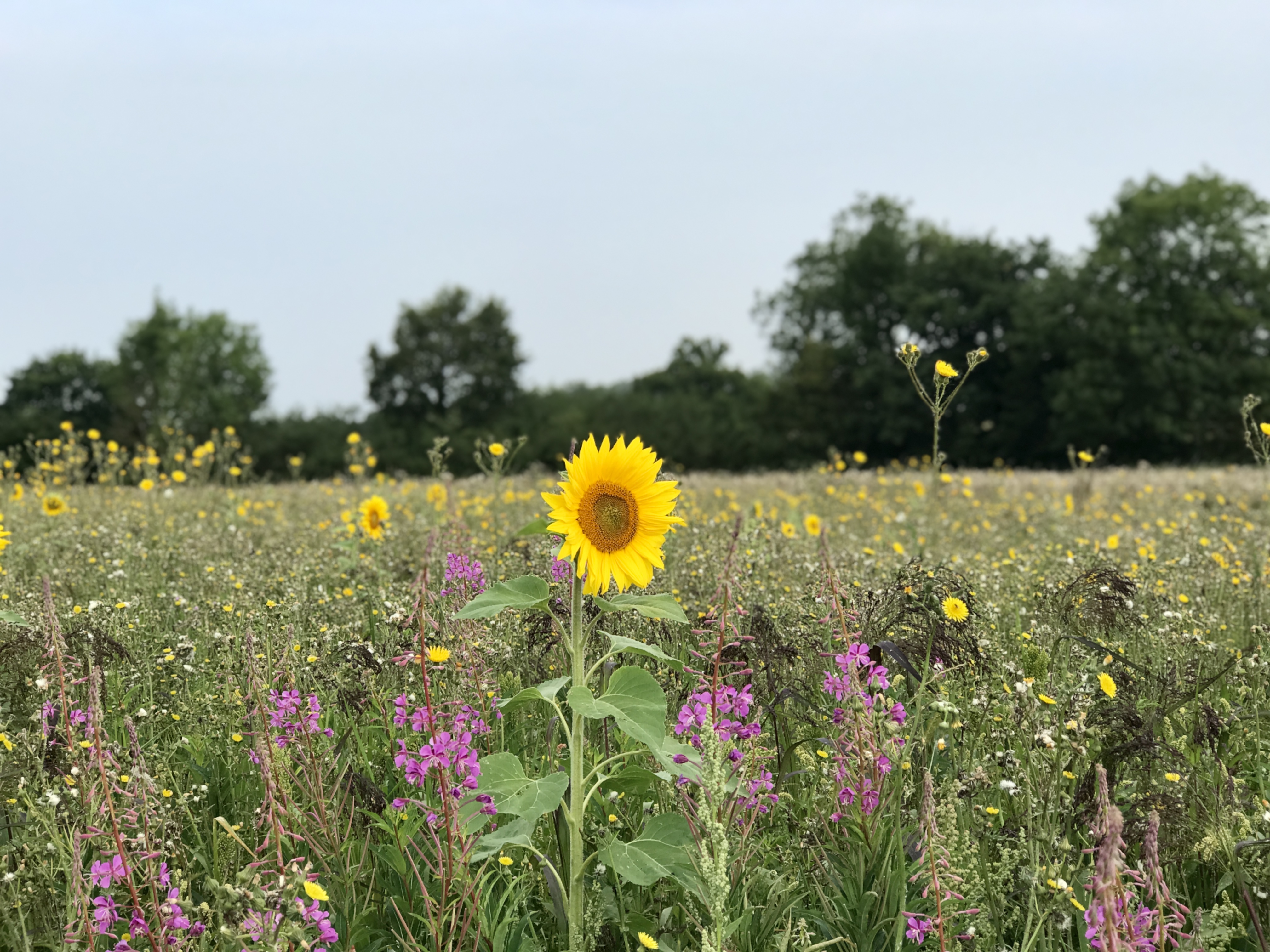
16, 17, 18, 19 miles. Past Edenbridge & we’re onto new paths! A field of sunflowers waving in the breeze distracts me as I cross a small grass airstrip at East Hasted Farm. I take far too many photos but the flowers are somewhat unexpected & beautiful.
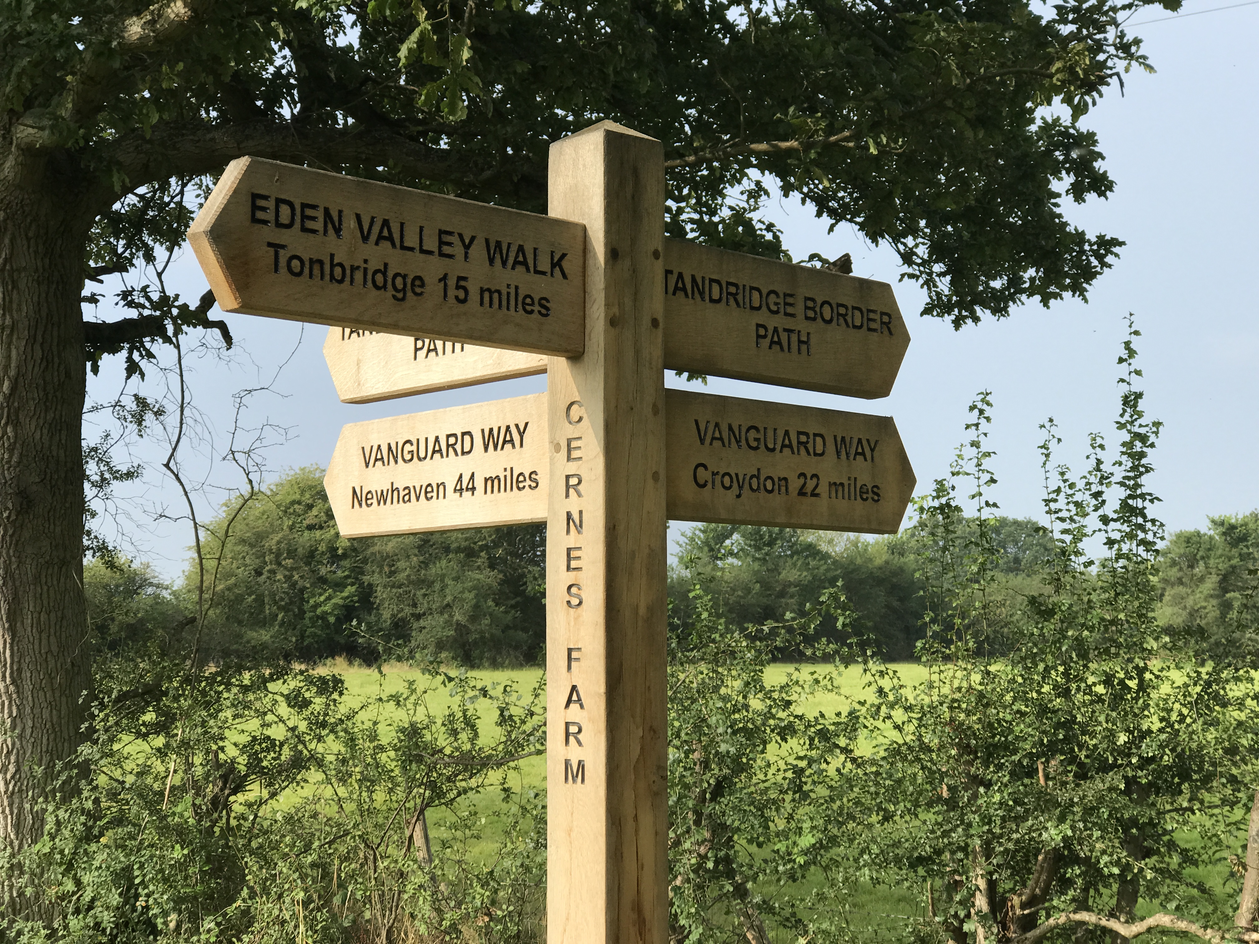
A few miles later, I photograph a Vanguard Way sign. It says 22 miles to Croydon, 44 to Newhaven. It’s only 9am & I am already one-third of the way but I still have a long way to go. This momentarily blows my mind. I post the photo to Instagram Stories, a little tease, & wonder if anyone will twig what I am doing. (The answer is, yes… take a bow SDW100 crew extraordinaire Nikki!)
28 miles in & I reach the small Sussex town of Forest Row. Having spent hours pouring over maps in the preceding two days, Forest Row with a conveniently placed shop, was one of the places I had earmarked for refuelling. I top up with a litre of water, 500ml of coke & 500ml of orange. And a Callippo. Always a Callippo!
From Forest Row, the route climbs steadily. I’m now carrying 2.5 litres of fluids & my bag suddenly feels very heavy again. A little grumpy with the extra weight it is not a good time for my first serious navigational challenge.
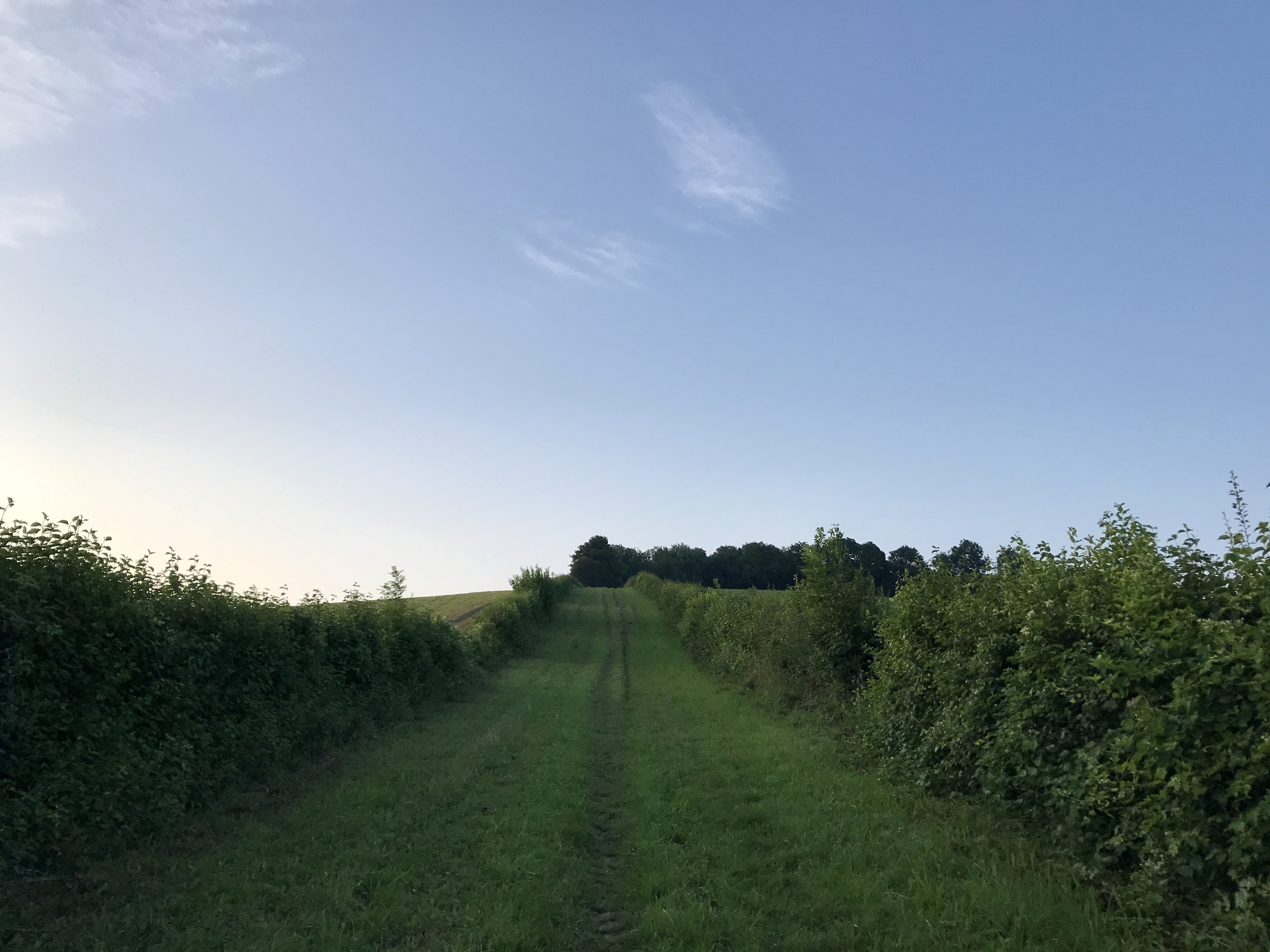
I’m trotting through a golf course when suddenly my watch beeps angrily to tell me that I’ve gone off course. But there was no other path. I took the only one. I turn, look around me. Wander up & down a little. By the thin green line on my watch screen, I can see that I have quite clearly gone wrong. Out comes the OS Maps on my phone. I trace my steps back, of course, it’s up a slight hill (isn’t it always?). At the top, there’s a bloody big Vanguard Way sign that I missed. But no path. Until I look closely. The tiniest of tiny gaps in the undergrowth, not even one leg width wide. I venture in & my watch beeps to congratulate me on finding the path again. Fighting my way through the overgrow I breathe once more.
The last golf course I crossed had a sign almost every 20 metres. This one has none. I am relying entirely on my watch for navigation which is good, but not perfect. In the next mile, I lose the trail another two times, becoming more & more frustrated. Normally I wouldn’t be so bothered, I’d just wander on until I picked the path up again but today it is really important that I stick to the route. I don’t want to make it to the end & to have my FKT application rejected because I missed a few hundred metres of trail when I got lost.
33 miles in & I lose the path yet again. My watch doesn’t pick it up. The trace on Google Maps doesn’t pick it up. The OS Maps app doesn’t pick it up. I go round & round & round in circles. The only time that any of them tell me that I’m on the path is when I am stood in the middle of an overgrown patch of trees where there very clearly is NO path.
I have a few choice words about the lack of signage as I traipse up & down. Just as I am ready to give up I spot a walker on one path, I ask him if he’s on the Vanguard Way & he says yes! Hoorah! The path is nowhere near any of the paths on any of the maps, my watch is still beeping angrily at me telling me that I am off course but at the bottom, there is a small, hidden, VGW sign. Why was there not one at the top?
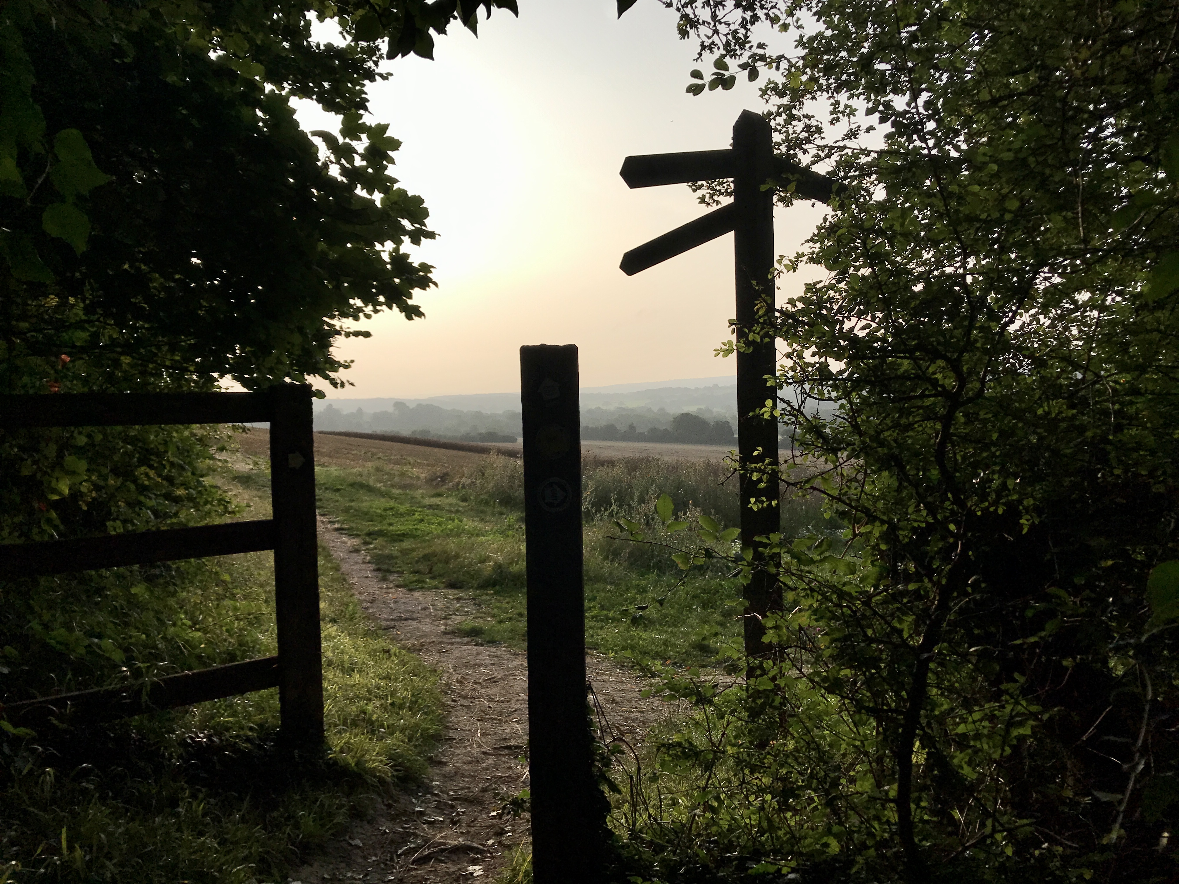
It’s a sign of things to come… Ashdown Forest is one of the wildest & most beautiful areas in southern England & part of the High Weald Area of Outstanding Natural Beauty. But does NOT HAVE A SINGLE VANGUARD WAY SIGN! I am relying 100% on my watch & with paths crisscrossing all over the place, it is tricky to navigate.
This is where I should have paid more attention to the Vanguard Way website in my planning. It states; “…waymarking of the VGW through the Ashdown Forest is under discussion & has not been implemented. …so you should concentrate on the route description.” Needless to say, I had not read the route description.
These miles are some of my lowest of the whole run. I have come so far but yet I am only just halfway. My mind wonders if I have another 30 odd miles in me, especially if navigation continues to be so tricky.
This was something I hadn’t anticipated at all. I knew that navigation would be a challenge, but at times it was so much harder than I thought it would be. Missing or non-existent signs (we don’t realise how lucky we are at the Croydon end of the trail). Paths that are so overgrown you can’t see them, the gates, stiles or the signs (those that aren’t missing). My watch is a lifesaver. There were a few times when it was slightly out but having it beep at me when I’d gone off course or missed a turning stopped me from making any serious navigational errors.
(Like ending up 20 miles from where I intended to be).
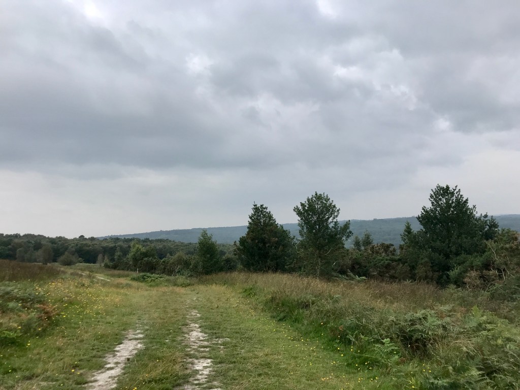
Despite its navigational challenges, Ashdown Forest is beautiful. A large area of woodland & heathland with stunning views overlooking the high weald. There’s an abundance of enticing paths & were I not trying to stick to a specific one, I would love to run off & explore. The trails are those slightly technical ones I love, a happy mix of undulating woodland, rock & stone. A few short & sharp climbs followed by a dancing decent as my feet jump from rock to rock.
Still no signs mind you.
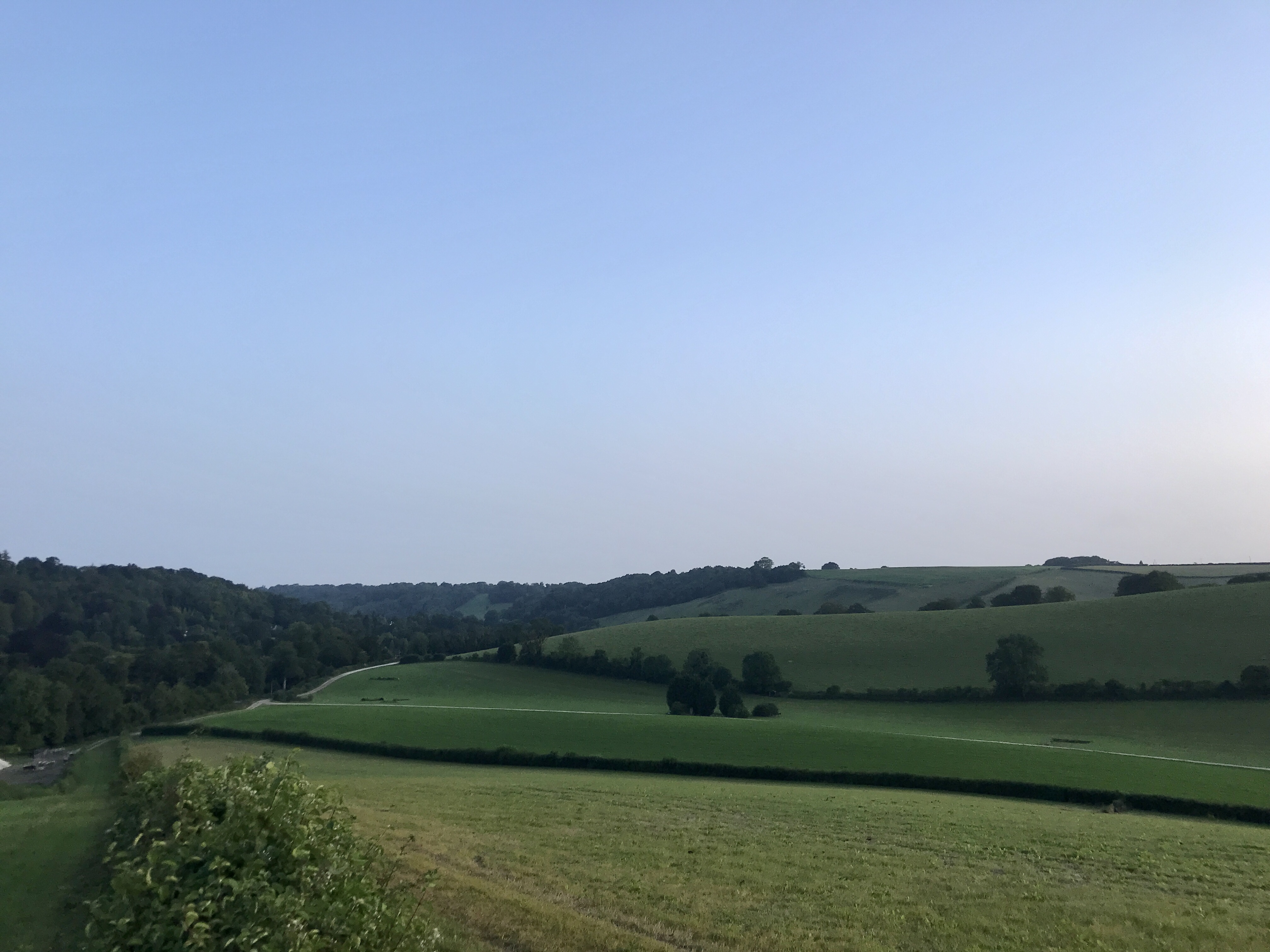
The next section passes by without a major event. Features have merged into one. Rolling countryside & small farms. Fields, overgrown paths, woodland trails & a little too much tarmac for my liking.
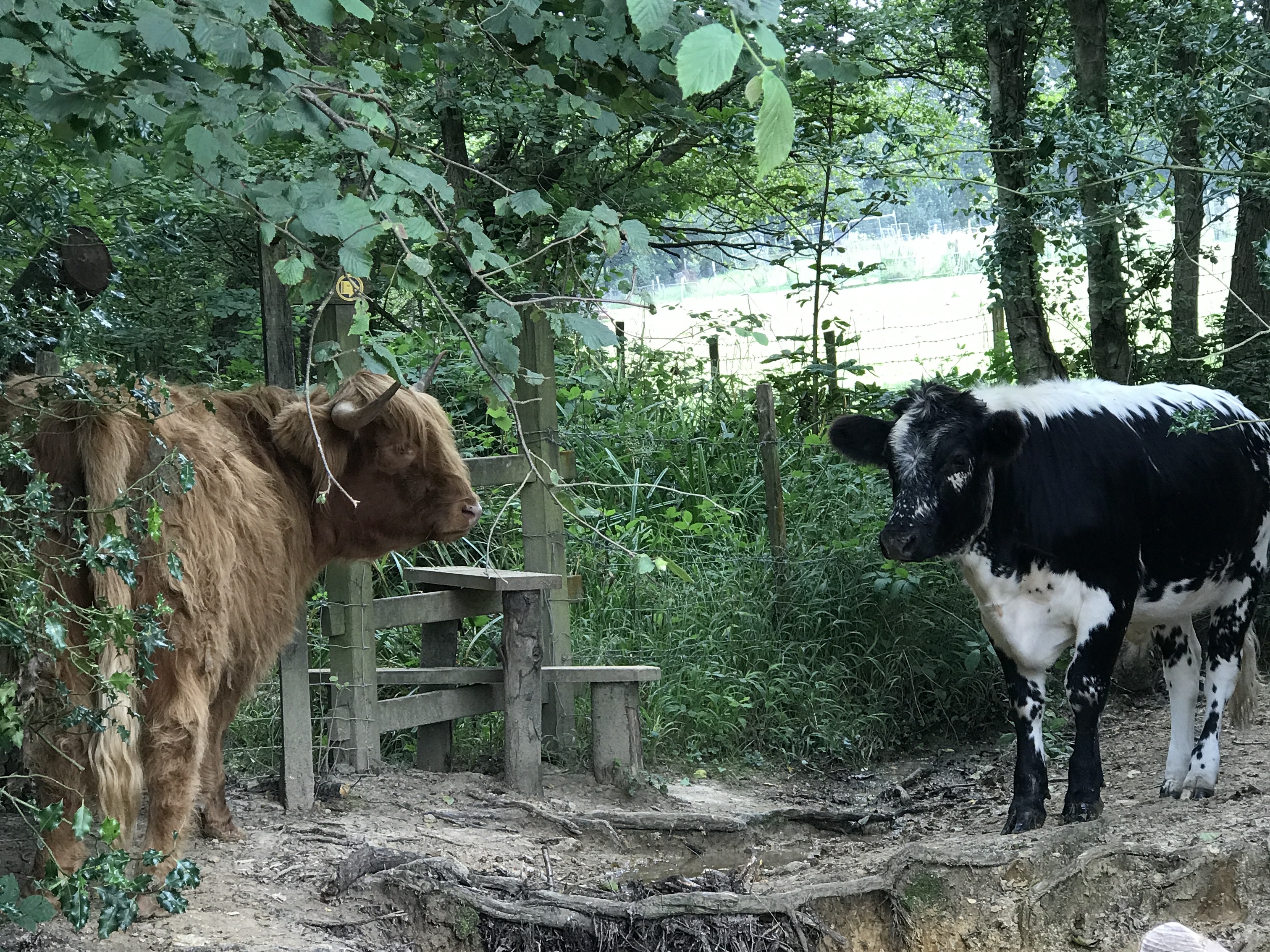
Across the River Uck & two angry looking cows are guarding the only stile out of a field. It takes me a good five minutes to wander around, discover that there is NO other option & that I am going to have to persuade them to move. With a little coaxing, they take a step to the side & I make a run for it & jump over the fence. Cows don’t usually bother me but these two looked a bit too mean & moody for my liking!
It’s 2:30pm, I’ve been going for close to ten hours & I’m roughly two-thirds of the way. After a fairly quick first 20 miles on paths that I knew well, the second 20 are frustratingly a lot slower as I battle with navigation, overgrowth & the tiredness that comes with long jogs. However, I’m still eating & drinking well, alternating a gel & solid food every 45 minutes.
A few miles later I cross paths with another walker, the first I had seen for a number of hours. Ankle deep in mud, we’re both deliberating whether we’re on the right path at the same time. The appearance of the other reassures us both that yes we are. We exchange a few words as he comments on my speed as I approached him. He’s walking the trail over five days & struggles to comprehend that I am trying to do the same in just one. We bid farewell & wish each other luck. I turn around a few times over the next mile or so & see him in the distance. Having been by myself for so long in a strange way it’s a little comforting that there is someone else out here on the same path as I am.
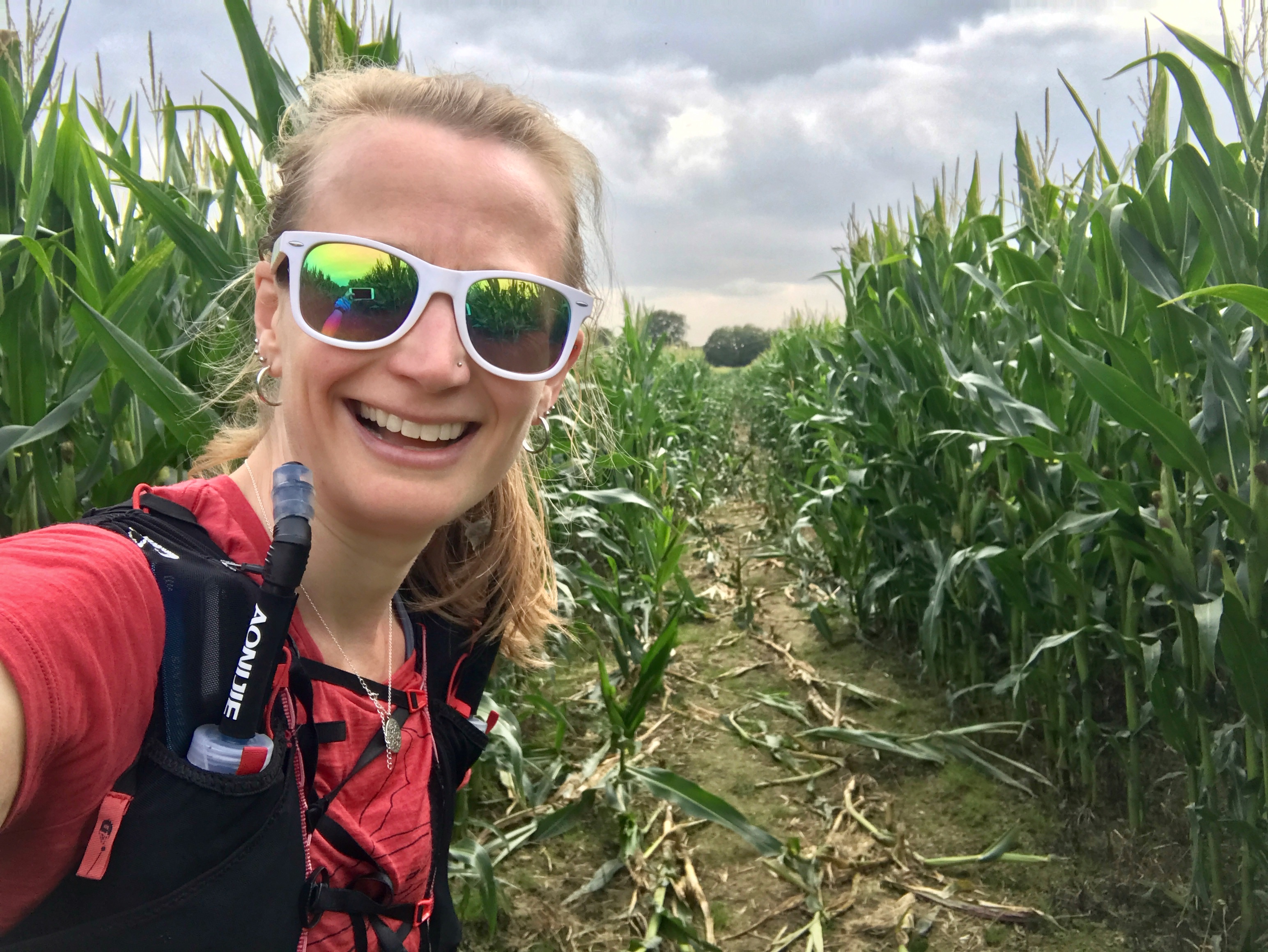
With most of the significant climbs now behind me, many stretches on this next section cross large fields, often with no distinguishing feature to use as a guide. At one point the path leads straight into a field of crops, taller than I am. Running through it feels almost jungle-like. With my farming heritage, I feel as if I should know what was growing, but sadly I don’t. Another similar field has no easy path so I end up taking a detour around the edge. I’m not happy about adding on extra mileage at this point of the run.
At 53 miles I take a planned 400m detour along the A22 to a garage to restock on supplies again. Knowing that I still have in the region of 15 miles to go, I have a moment when I realise that this road would take me all the way back to Croydon.
Usually, by this point in an ultra-marathon, I am struggling with nutrition, feeling nauseous & unable to eat any significant food. Today I am ravenous with not a hint of nausea. I top up with another litre of water, coke & an orange drink. I also grab a hot vegan sausage roll & flapjack. With a distinct lack of seating options I sit on the floor of garage forecourt to the amusement of passing motorists, to eat & drink. Zero fucks given. A vegan sausage roll has never tasted so good. It hit the spot & I am rejuvenated.
It’s a 400m trot back to the trail, a bonus half a mile in total but a much-needed refuelling stop. I decide I should probably phone the husband to tell him how long my long jog actually is… He seems remarkably unsurprised.
And on I go.
Across a busy main road, the first time I’ve had to stop for traffic since leaving Croydon. I struggle to find a path hidden between buildings. I’m tired & every little navigational hiccup now becomes a major drama that leaves me increasingly frustrated. Whilst running tires the body, being constantly alert to maps, signs & paths tires the mind.
The path passes by the ancient Berwick village church & rounding a corner I’m greeted by the welcome sight of the South Downs. I pause & greedily drink the view in. This view makes me smile. I search for familiar landmarks that have so many memories associated with them. I think I can see Firle Beacon which means the hill to the right is the climb out of Southease & the hill to the left is the climb from Alfriston to Jevington.
Knowing where I am soothes my mind. I feel a new calmness settle on me. I am at home in the South Downs. My mind wanders back to June’s SDW100 & running along the hilltops that I now stand & look up to. A path so familiar to my feet, though I’ve never seen it from this viewpoint before. I also know that once I get to Alfriston I won’t need to worry about navigation.
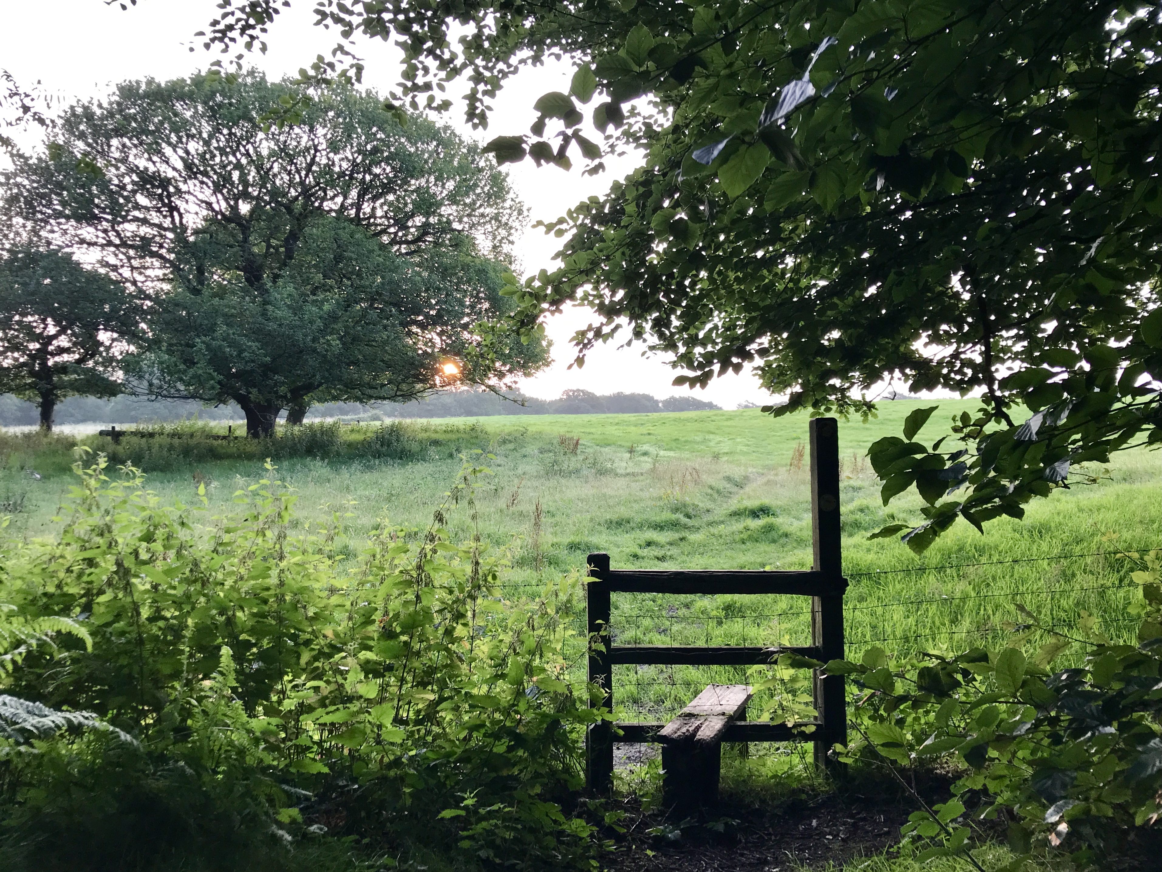
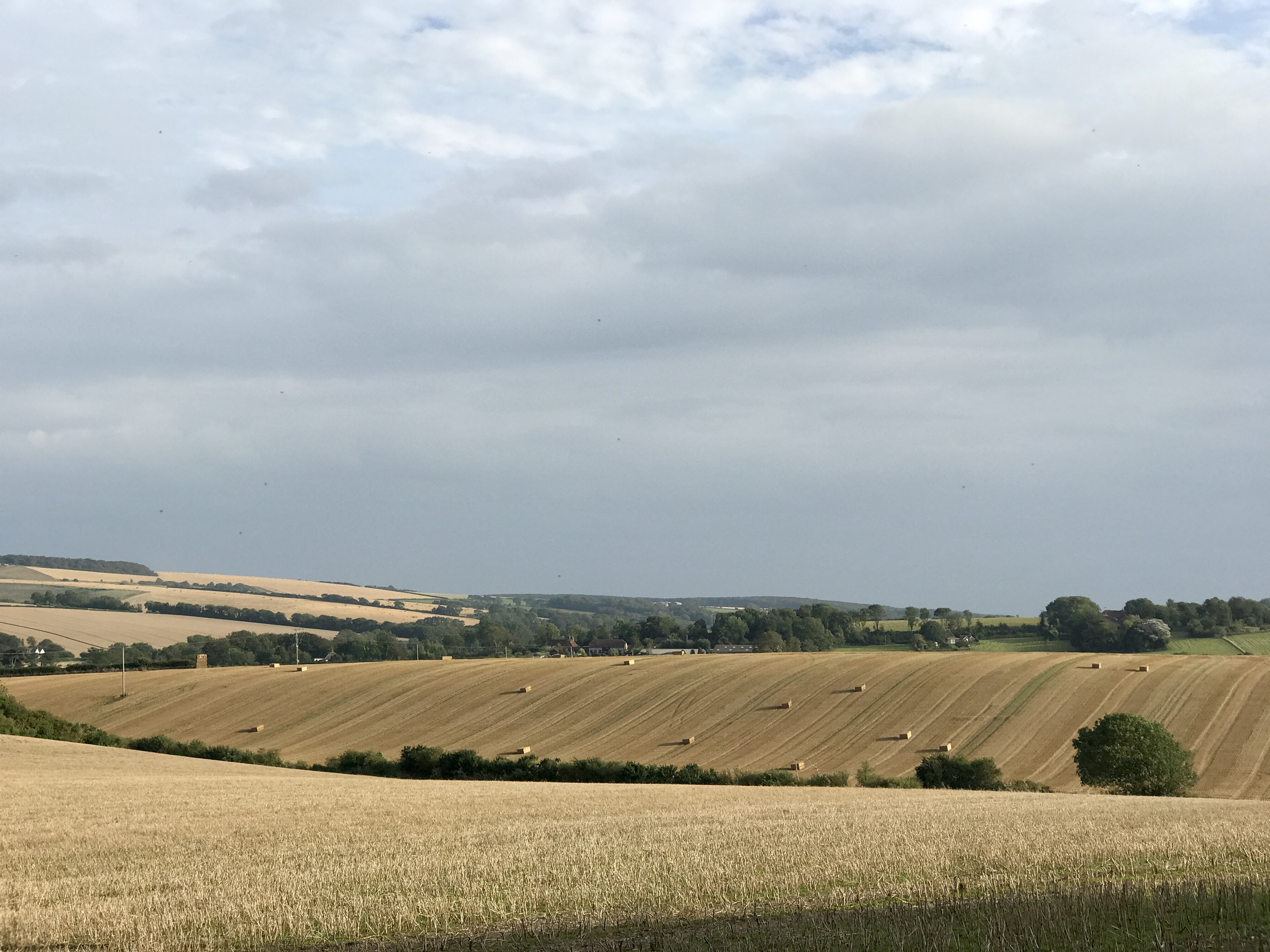
I run across quintessentially English fields, recently harvested & lined with giant hay bales. Grazing sheep in neighbouring fields cast a wary eye over me as I clamber over a stile & up a small hill.
The sun is sinking lower in the sky as the afternoon draws into the early evening. I’ve lost all concept of time but golden hour is fast approaching. That magical time of neither day nor night when the sun is low in the sky, its shadows long, its tones warm & golden. I estimate it must be around 7pm & that I have about four hours & nine or ten miles to go.
Running down a small road I arrive in Alfriston, the largest town for quite some time, (but still not large enough to have a shop open past 5pm – thankfully I still have plenty of supplies). The Vanguard Way converges with the South Downs Way. I know I can now simply run. I don’t need to think about navigation or where to go until the trails split again at Cuckmere.
I am slowing quite considerably, even on the flat path following the meanders of the river. I start to anxiously look at my watch. It gives me an ETA for Newhaven & I am well within my target of the last train, but I’m conscious that I want to keep a little bit of a buffer. I move forward without thinking. Another runner overtakes me & I want to shout out, tell him what I’m doing, explaining my slower than usual pace. Needless to say, I don’t!
After miles of relatively ‘flat’ running, the climb out of Litlington comes as somewhat of a shock. I pause at the top to refill my front flasks from the bottle in the back of my pack. Down through Friston Forest, into Westdean & up the 152 steps towards Exceat. I climb in excited anticipation.
At the top is one of my favourite views, Exceat looking out over the Cuckmere Haven.
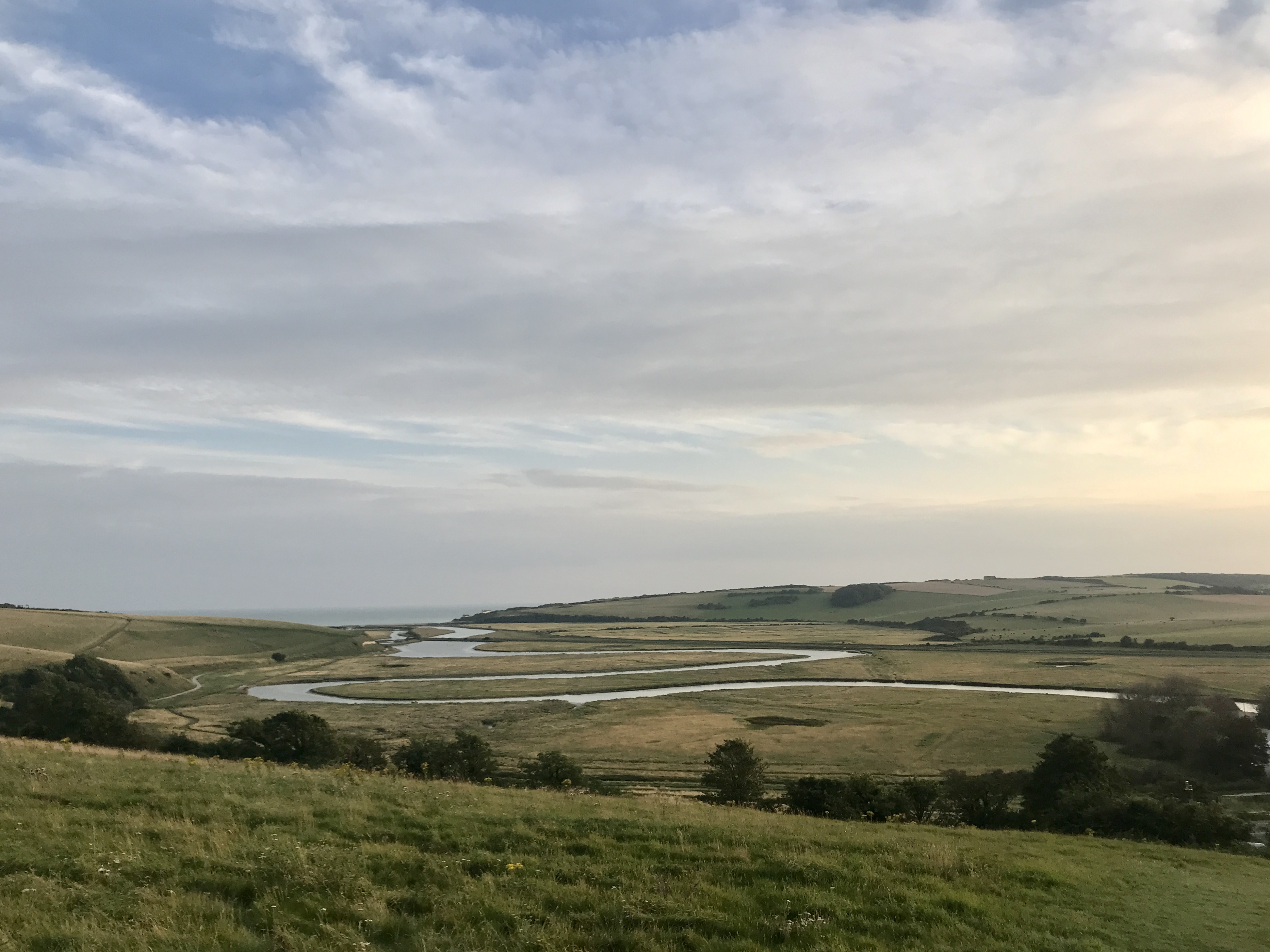
The Seven Sisters to my left, Seaford to my right. I pause, absorbing the scene, taking it all in. Once a regular running haunt, with lockdowns & travel restrictions it’s been far too long since I have seen this view.
I fly down the hill & for only the second time turn right at the bottom. The VGW meanders its way alongside the river, a slightly different path to the one I took only three weeks earlier when I ran from Eastbourne to Seaford. Then I hugged the river edge, today the VGW takes me a little further away from the riverbank.
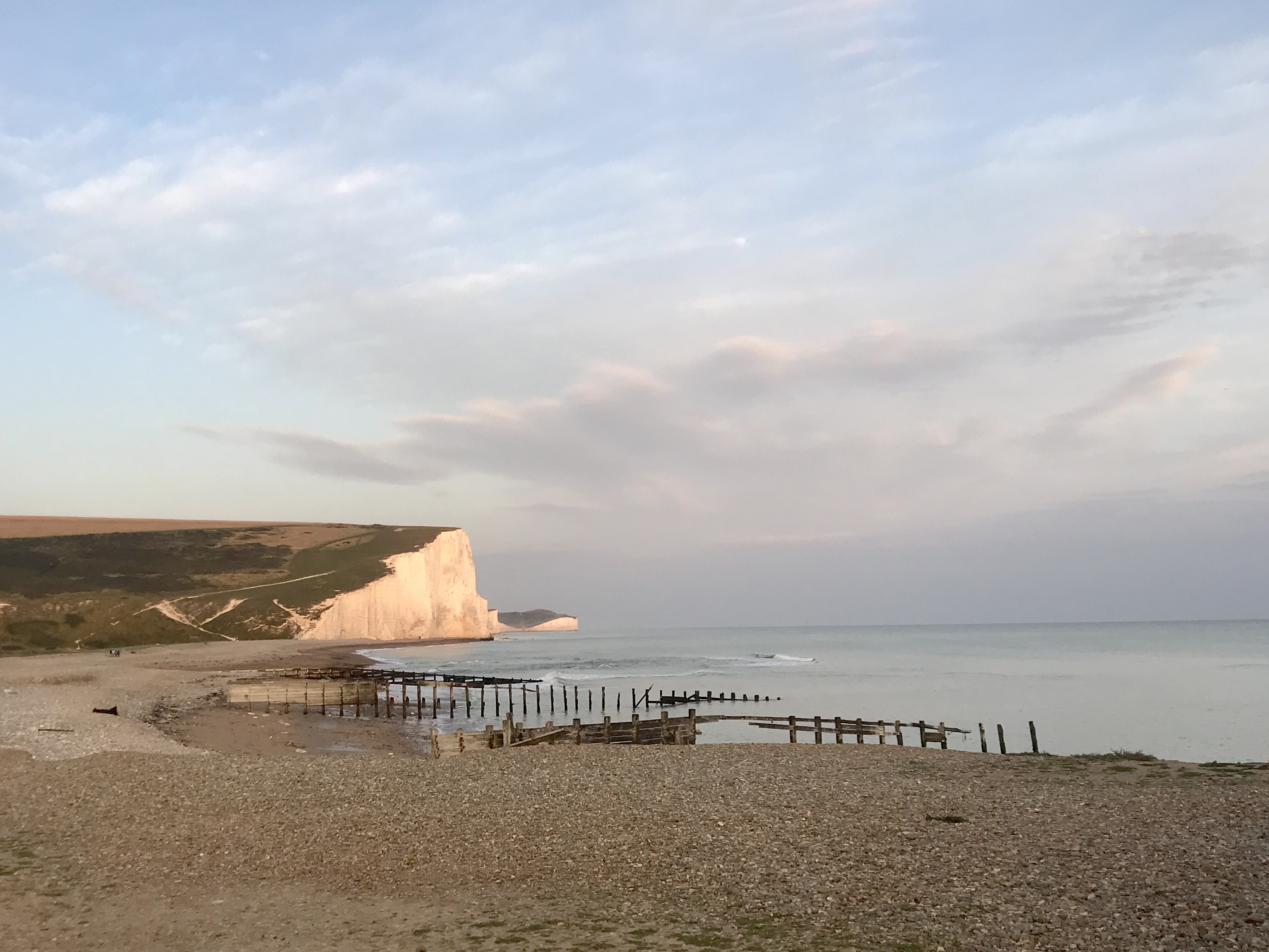
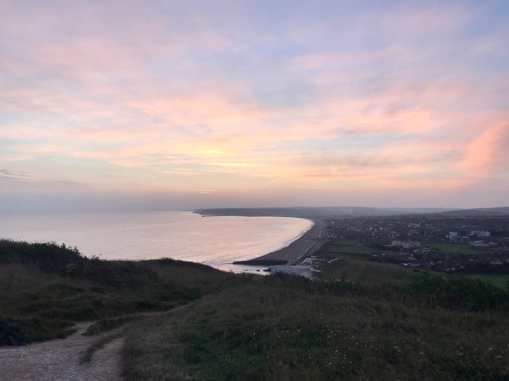
The last significant climb is up from the mouth of the river to the clifftops at Seaford Head. I turn to look at the iconic vista behind me. The white cliffs of the Seven Sisters that I have run over so many times, today glowing pink & orange in the setting sun.
The popular coastal path is almost deserted. I have never run along the clifftops when it’s been quite so quiet & there is something quite enticing about it. A bit like running through silent woods at night. If I had more time I could quite happily have sat in the stillness & simply watched the ocean. But I don’t. I have places to be.
More importantly, I have about five miles to go.
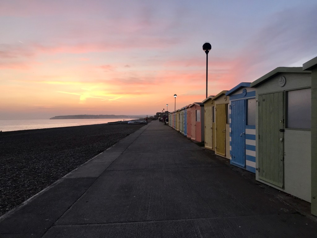
Soon I see Seaford, the small town before Newhaven. The sky ahead of me is a riot of pinks & blues. Turning to have one last look behind me I descend from the cliff tops to sea level & follow the long stretch along Seaford’s promenade.
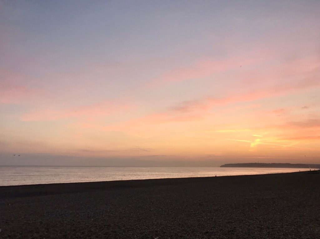
These last few miles are some of the toughest of the whole run. The hard concrete of the promenade is a shock to my tired feet. Running is painful. I trundle slowly along, determined to keep up some semblance of a run rather than slowing to a walk. As I run, I watch a large ferry sail into the port at Newhaven ahead of me.
At Bishopstone, the VGW leaves the seafront & turns slightly inland. I reluctantly stop & put my head torch back on. I’d really been hoping to finish in daylight but it’s approaching 9pm & away from the streetlights it is now pretty dark.
The path reverts back to trail. It’s a narrow single track on top of a bank. To the left of me is a pool of dark water, to the right a narrow stream & derelict buildings. The path is so overgrown that sections are completely impassable. At times I’m clambering down the bank hoping I don’t fall into the creek. The only light I have to see with comes from my head torch. One false move & I could easily be in that water. I feel uneasy for the first time during the whole run. I have less than a mile to go.
I later learn that the derelict buildings are the abandoned village of Tide Mills. Abandoned buildings weirdly intrigue me & I am slightly disappointed I didn’t get to see them in the daylight.
The trail turns once more road & I am running alongside a railway track in what feels like a small industrial estate. It’s late, it’s dark & I admit I feel slightly anxious. It’s not the most salubrious end to the run.
The end of the Vanguard Way is so unceremonious that I almost can’t find it & gain an extra few hundred metres running around in another circle. Within the industrial estate, behind a small row of houses sits Newhaven Harbour train station. The trail end. A small, insignificant station with only one or two trains an hour.
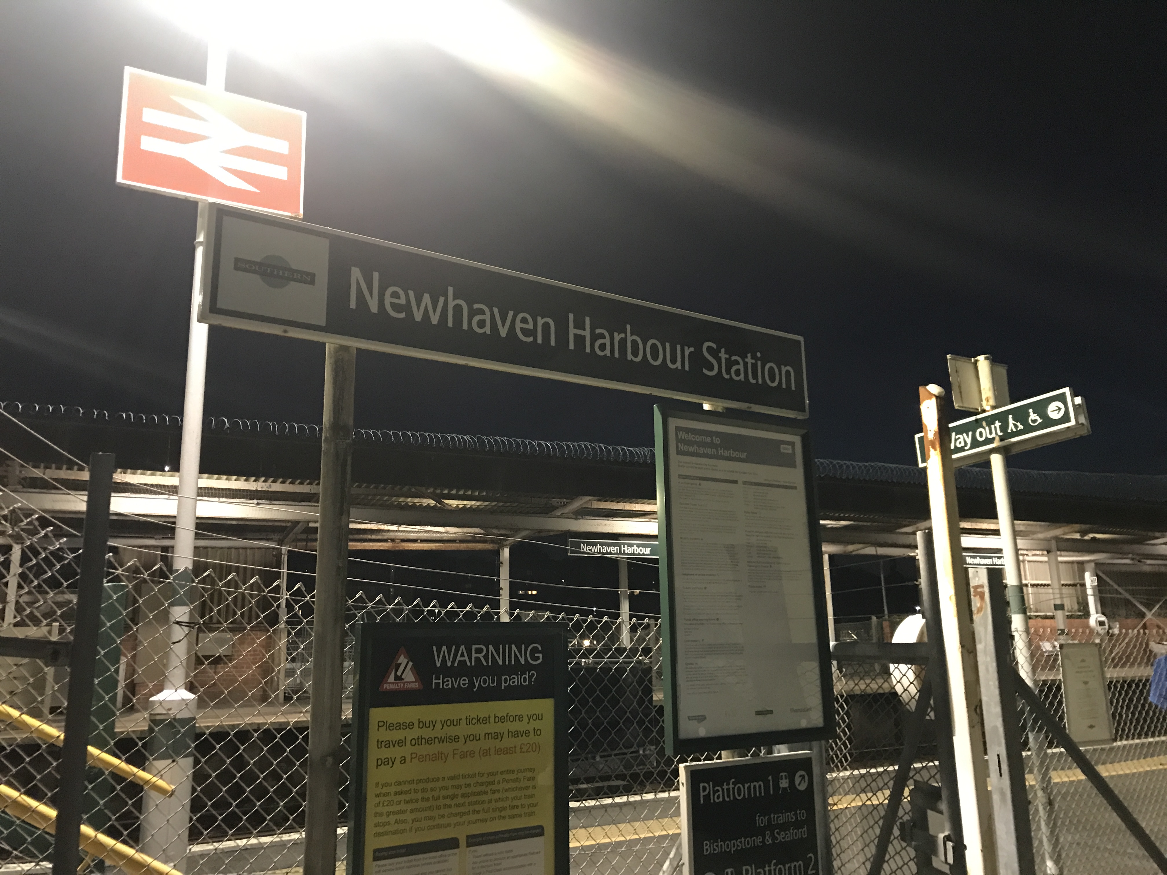
9:18pm. I stop my watch & whilst jubilant to have finished, I am also slightly disappointed at the insignificance of it.
16 hours, 26 minutes & 52 seconds.
I covered 71.3 miles (the route is advertised as closer to 68 miles).
It’s another half mile or so to the slightly better served Newhaven Town station where I have a 30-minute wait for a train back to Croydon via a change at Lewes. This gives me just enough time to pop into the neighbouring McDonalds to change out of my damp & sweaty run kit, wash my hands (glorious after 17+ hours!) & grab some food.
A Veggie Deluxe & portion of chips is the first McDonalds I have eaten in about 20 years & my god, after 71 miles it hits the spot & was absolutely DELICIOUS!
Four days later this was verified as the female Fastest Known Time (FKT) on the Vanguard Way.
I have an FKT.
Me, an FKT!
Reflection
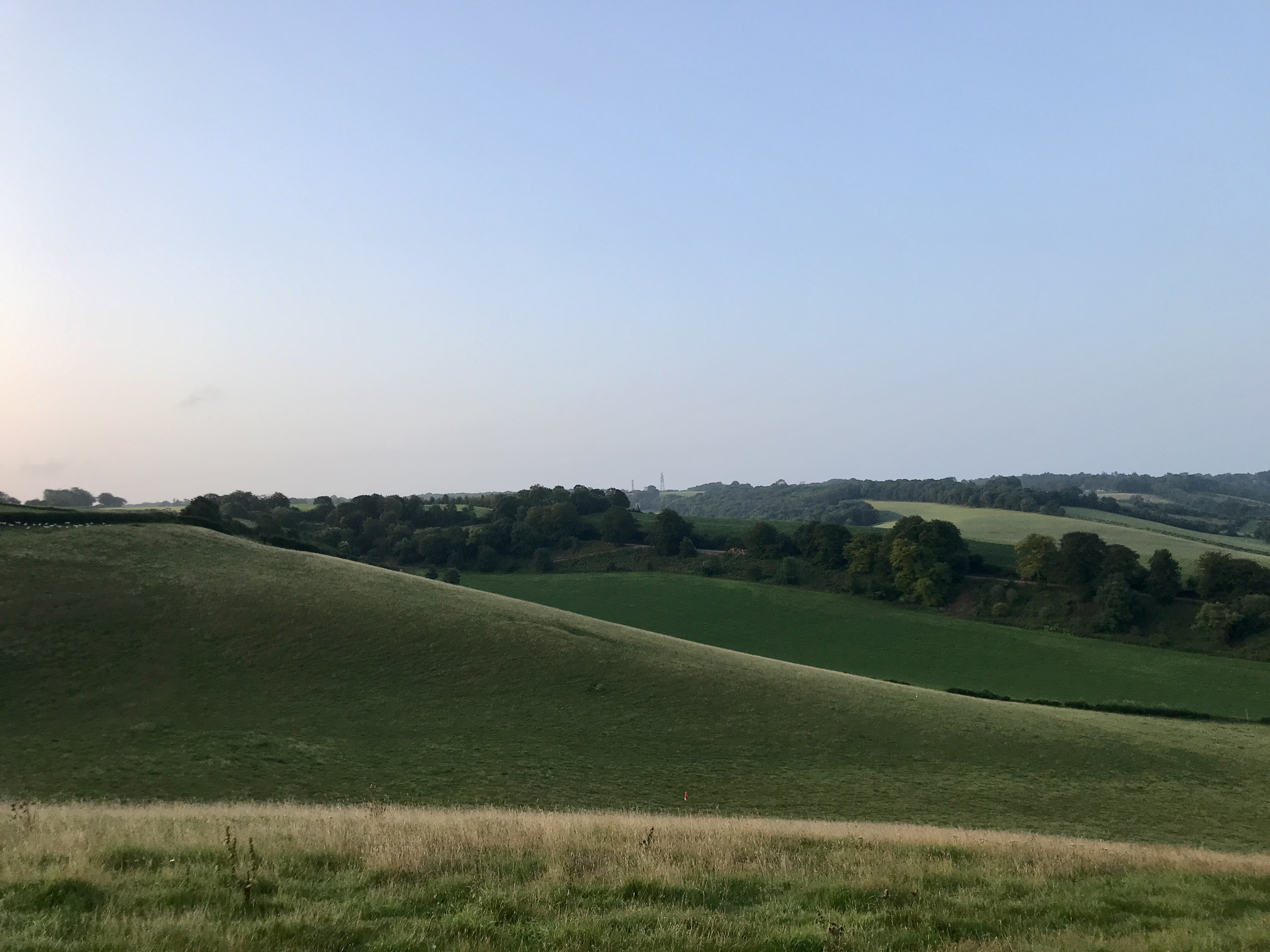
One of the joys of exploring the whole trail was discovering the huge variety of countryside & terrain it runs through. It passes through parkland, woodland, open countryside, farmland & heathland with expansive views over the Surrey Hills, High Weald, South Downs & the Sussex Coast. In Ashdown Forest it crosses a watershed: all the streams above this point generally flow northwards into the Thames, while those in later sections generally flow southwards into the English Channel.
Part of me wishes I had read more about the trail before embarking on my adventure as only now am I learning about some of the rich history & heritage of the path I travelled.
From Roman roads to 13th century Churches. Pretty villages, mills, ancient iron age forts & the abandoned village of Tide Mills in the last few miles of which I knew nothing about as I rushed in failing light to the finish.
Maybe one day I will have to return at a more leisurely pace to take it all in.
A few weeks have passed & as I look back on my Vanguard Way adventure I am immensely proud of what I achieved that day in August. Although the catalyst to the journey, the FKT is simply the icing on the cake.
For me, the real challenge was believing I could & then actually doing it. Believing that I could run this kind of distance completely alone. Navigating paths I didn’t know. Dealing with navigational errors. Carrying all my kit & supporting myself. For some, all of this may seem insignificant but this was a first for me, a big deal.
In the same way that the club run on the Vanguard Way in 2016 lit a fire in me, this Vanguard Way run in 2021 has lit another fire.
I want more adventure.
I want more challenges.
All day I was in my element, at home on the trails.
I may have fallen over (twice, first down a hole, second off a stile…!).
I may have been scratched by brambles, stung by nettles & bitten by bugs.
I may have gotten lost.
I may have had a minor hissy fit at the lack of signage.
But for that one day, I was entirely self-sufficient.
I needed nor wanted anyone or anything else.
In a somewhat chaotic world, I found the silence & solitude of being alone calming.
Looking back, I crave the respite of that adventure, that challenge & that peacefulness.
Simply, I proved to myself I can. I am capable.
And I want more.
I’ve come a very long way since I first ran on the Vanguard Way five years ago.
Details
Kit
I wore Hoka Challenger ATR 5’s. I normally love these shoes & they were great on the trail sections but there was a lot more tarmac than I was expecting. I almost wish I had worn road shoes for extra cushioning, By the end my feet were very painful.
I used my Garmin Fenix 3 & iPhone 7+ with the OS Maps app for navigation.
I used the Salomon adv skin 12 race pack. In this I carried:
- A full change of clothes including underwear, socks, leggings & a base layer
- Waterproof jacket
- Deodorant
- First aid kit
- Foil blanket
- Battery pack & chargers for my phone & Garmin (both needed)
- (this were all stored in an XS dry bag)
- Headphones (not used)
- Hand gel, mask, vasaline, tissues & other small misc. items.
Drinks
I started with:
- 1.5 litres of water
- 500ml of squash
I had two 500ml soft flasks at the front of my pack & stowed the rest in the back of my pack to top up with when needed. I used one 500ml hard flask that I refilled & one normal 500ml bottle that I disposed of when used (in a bin) in an effort to reduce weight.
- At mile 28 I topped up with 1 litre of water, 500ml coke (into hard flask) & 500ml of orange
- At mile 53 I topped up with 1 litre of water, 500ml coke (into hard flask) & 500ml of orange
Food
- 4X Peanut butter & jam sandwiches on brown bread (I had run out of my usual white wraps)
- 2X Cheese sandwiches
- 1X Banana
- 2-3X Fig rolls
- 1X Fruit bars
- A handful of Jelly sweets
- A number of GU gels (one approx. every 90 minutes)
- Vegan sausage roll
- Half a flapjack
- 2X calippos

Love it, really excellent write up. Well done on your FKT, awesome stuff.